View Source | December 8, 2014
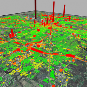
 ASU's Hestia Project, led by Senior Sustainability Scientist Kevin Gurney, combines extensive public database “data-mining” with traffic simulation and building-by-building energy consumption modeling. The resulting high-resolution maps clearly identify carbon emission sources in a way that policymakers can use and the public can understand.
Gurney presented his research on Dec. 5 during the United Nations Climate Conference in Lima, Peru, where delegates from 190 countries are receiving urgent messages about global warming. His talk is part of a session on understanding the carbon emissions of cities, and will focus on applying urban carbon data to address the needs of local decision-makers and planners.

