Next City article on WaterSim

As uncertainty about water access in the West increases, the Decision Center for a Desert City at Arizona State University is connecting policymakers with research to make better resource management decisions for the future.

The DCDC has been conducting climate and water research in the Phoenix metropolitan area since 2004. Now, thanks to a $4.5 million grant from the National Science Foundation — the third made to DCDC by the NSF since its founding — the DCDC will expand its work beyond Arizona to other cities dependent on the Colorado River Basin in Colorado, Nevada and California.
CAP EastValleyAg Sep4 2015

The funding comes from the NSF’s Decision Making Under Uncertainty program. The DCDC and other groups receiving this funding aim to increase information available to decision-makers by developing analytic tools, facilitating interaction with researchers and bringing decision-makers together.

“We’re a boundary organization,” says Ray Quay, director of stakeholder relations at DCDC. “We try to bring science into public policy.” In Phoenix, the DCDC does this in part through collaborative research. Using satellite imagery, DCDC helped the city better understand how changes in water demand over time are related to changes in land use. The DCDC will now work to identify similar opportunities in Las Vegas and Denver, the first cities that will benefit from the expansion.

The DCDC also hosts “neutral convenings” in the Phoenix area where policymakers come together to discuss environmental concerns and solutions — topics that can ignite heated arguments in some places — and learn from one another in an uncharged space. For one such meeting, the DCDC brought together water managers from across the region with different viewpoints to discuss research and decision-making strategies about a potentially divisive issue: How should cities respond if an extended drought requires them to shift from using surface water to groundwater, what DCDC calls the “All Straws Sucking Scenario”?

“Arizona water is highly regulated, and water utilities are uncomfortable being open in discussion when an agency that regulates them is part of the discussion,” says Quay. DCDC was perceived to be an unbiased host.

Expanding into Denver and Las Vegas, the DCDC will conduct surveys of the general public and water managers to identify problems, areas where agencies feel they have answers to share and topics requiring regional discussion.

One of the organization’s primary research and education tools is WaterSim 5.0, which estimates water supply and demand for Phoenix and the 32 cities in its metropolitan area. Users can control as many as 53 inputs, including river runoff, percentage of wastewater reclaimed, population growth, and per capita water use, and then see the impacts of these decisions on water supply, water demand, and a variety of sustainability indicators.

David Sampson, WaterSim’s lead developer, says the tool was originally intended to help water providers with planning, but that the program isn’t yet perfectly suited for their needs. “The nice thing about WaterSim is that it’s an aggregate of all the cities,” says Sampson, “but the cities of course only work within their own [boundaries].” One goal with this round of NSF funding is to allow finer spatial parsing of WaterSim’s region, allowing water providers and managers to make finer-grain decisions. Sampson is also working to integrate a groundwater model that is based on supply rather than credits.

At present, WaterSim is primarily a tool for education and outreach, and the DCDC has also created a less complex educational model, an online version that has just five inputs. WaterSim can be used “to tell stories,” says Quay, by leading members of the public and elected officials in a guided discussion using the interface. “One story might be that there is no silver bullet.” As people better understand the complexity of the system, supplies and management, they see that “there really is no one solution under the uncertainty of climate change and drought,” says Quay.

Another story is that “it’s not just the system that’s complicated, but how people use the system and benefit from the system that’s complicated as well,” says Quay. Farmers value water differently than manufacturers, who value water differently than homeowners or environmentalists. “They all have different perspectives on what sustainability means,” says Quay. “Using this tool we can show how to maximize sustainability from all of these viewpoints, but that there’s no way to maximize sustainability for all of these viewpoints.”

Quay says it’s unclear how the DCDC will extend its modeling capacity to include other Colorado River Basin cities. It will depend on whether different regions will see a benefit, he says, and what types of modeling systems they already use.

The DCDC is working to create more educational modeling tools, though. Sampson is developing a scaled-down water supply and demand simulation for a traveling Smithsonian exhibition that will visit all 50 states in the next five years. Sampson and the DCDC will create a model for every state, with elements that look at climate change and human use.

“People can learn a little more about water decisions and water use and how that relates to climate change,” says Sampson. “Every state has a different challenge.”

Source:
By Jen Kinney
September 24, 2015
New City – The Works
The Works is made possible with the support of the Surdna Foundation.

Managing Water for Irrigated Agriculture in the Central Arizona Desert

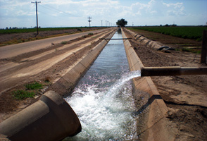
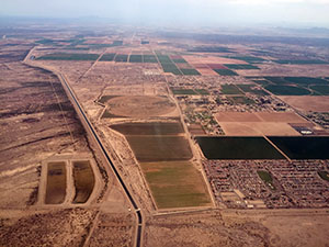
Farmers in arid central Arizona have always faced a formidable climatic challenge. The region around Phoenix receives a scant fraction of the annual rainfall needed to irrigate traditional crops like alfalfa and cotton, and summertime high temperatures make it the hottest metropolitan area in the United States. Nevertheless, infrastructure improvements and policy have made both booming urban development and exceptional agricultural yields possible in the Phoenix area over the last few decades. These developments, however, have also buffered farmers from directly experiencing signals of climate change.

Eakin_IrrigationCanal2

This may now be changing. The severe drought conditions that have affected the West since the turn of the century have called into question the long-term reliability of the Colorado River system, which has underwritten regional growth. Some irrigation district managers are now reexamining expectations about how much water they can deliver to agricultural water users. For instance, one irrigation district manager said, “We have to plan for the future. If we know we’re going to have a dry year and I know the reservoirs are really low, if we think there’s going to be a shortage then we’ve got to do something, to either get more wells in or let the farmers know. We’re probably their best source of information.”

Monitoring future supply

Understanding how farmers and irrigation district managers use climate information has been a priority in research supported by the National Oceanic and Atmospheric Administration (NOAA) at Arizona State University, in collaboration with the University of Arizona Cooperative Extension Service. Irrigation district managers cannot rely solely on local forecasts for their decision making: some monitor stream gauges located on Colorado River tributaries more than a thousand stream-miles away. Many managers keep track of how policy decisions about reservoir management, energy production, and inter-sector water allocation may affect the quantity, quality, and cost of the water they access. An irrigation district manager explains, “We use NOAA, I use the ski reports a lot from Colorado because you can get all the averages and see what it’s done in the past week so you know if you’re gaining or losing snow.” In turn, these managers try to pass on this information to users, including farmers, whether through official channels or during informal meetings on ditch banks and in coffee shops.

Additional adaptation strategies

Improved information is only one part of the adaptation puzzle. Irrigation district managers are now thinking creatively about how to ensure that infrastructure is maintained to allow flexible adjustments between groundwater and surface water sources. During a water shortage, limitations on groundwater pumping capacity can be just as challenging as getting enough water for crops. Depending on the ownership and control of groundwater wells within a district, managers can strategize by running only the most efficient wells, ensuring that pumps in the same location aren’t running at the same time, and by making substitutions between local water allotments to keep operational costs even. Some are also engaging directly with water suppliers and utilities outside the region to ensure reliable and affordable access in the future. For the first time, in 2015, some central Arizona irrigation districts are volunteering to forgo a portion of their water allotment in the reservoir behind Hoover Dam as part of a multi-state experiment in extreme drought operations. Others have forgone groundwater pumping through water banking agreements.

Urbanization, competition for water and land, and volatility in agricultural policy, as well as energy and commodity prices, challenge efforts to further innovate in water practices. While farmers hope to continue contributing to the rural economy, they worry that their long-term viability will depend as much on how state and city managers value their presence and resource needs as it does on their own capacities to proactively respond to rapidly changing water supplies.

[iframe src=”//player.vimeo.com/video/86935576″ width=”500″ height=”281″]

Working with the farming community

Farmers in this region come from a community shaped by generations of coping with extreme heat, and they are experiencing an extended drought. They are also literally losing ground to urban development. Many are apt to focus on what is familiar and near, depending upon strategies they have used in the past. For example, a third-generation farmer in the area explained, “The standing water table depth when my dad bought this farm was about 20 feet, and the last time we measured it was 25 feet to the water, so the depth to the water is very shallow. Right off the bat the thing that it tells you is that we are not pumping fossil water, it absolutely is rechargeable.” Farmers’ knowledge and experience comprise rich, site-specific detail, on a different scale and often with contrary implications compared to observations made by policymakers and researchers. Effective policy dialogs need to respectfully bridge these differences.

The past success of efforts to secure and diversify water sources may have created new, more obscure, vulnerabilities and interdependencies. Like generations before them, farmers today are independent entrepreneurs. Nevertheless, the outcomes of individuals’ decisions have never been more contingent upon each other: from maintaining local irrigation ditches and district wells, to balancing demands from major interstate water and energy generation infrastructure, farmers are not only needing to collaborate with each other, but also with others representing urban, energy, and ecological interests in Arizona and in neighboring states. It will take a continuing effort by all interested parties in central Arizona to learn to accommodate uncertainties in water supply and tradeoffs in water use decisions into the future.

Source: U.S. Climate Resilience Toolkit

Story Credit:
Skaidra Smith-Heisters and Hallie Eakin, Arizona State University.

Banner Image Credit:
Hallie Eakin, Arizona State University