Atlanta

Atlanta, Georgia: Historic Fourth Ward Park

City: Atlanta
Country / US State / US Territory: Georgia
Type of Solution: Vacant Commercial Properties and Lots
Climate Impact: Extreme Temperatures and Urban Heat Island Effect; Air Quality; Extreme Precipitation and Flooding
Social Value Created: Social Cohesion; Quality of Life; Public Health and Safety; Diverse Transportation; Historic Preservation; Public Spaces; Active Living and Playspaces

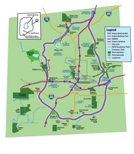
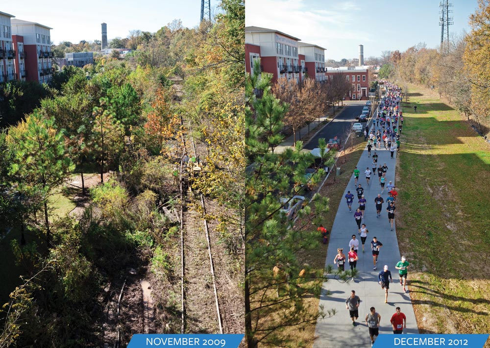
A former industrial and commercial property has been revitalized to become a 17-acre urban park, Historic Fourth Ward Park. The park is adjacent to the Atlanta BeltLine project, a rails to trails project that is restoring 22 miles of abandoned railway beds into recreational trails and a streetcar line. The $ project was completed in 2011, and the use of green infrastructure opposed to traditional gray infrastructure drainage system the city is estimated to have saved $15 million.

The park is located in an area that historically has experienced flooding and sewer overflows during storms. The green infrastructure system, consisting of bioretention, underground cisterns, and pervious surfaces, will help to improve stormwater management, with the capacity to capture runoff for a 100-year storm. Preventing sewer overflows helps to counteract the spread of waterborne diseases, contributing to public health.

One of the park’s features is a two-acre stormwater detention pond, Clear Creek Basin, which has already helped to reduce flooding in the surrounding neighborhoods. The Basin not only reduces flooding, but it also acts as a water reserve providing 425 gallons per minute even during a drought. The Basin was designed to use plantings and landscaping strategies used in wetlands.

Additionally, the greenspace improves air quality and contributes to urban cooling, mitigating extreme temperatures and the urban heat island effect. Trees and play structures increase shade, improving the comfort of community members and their overall quality of life.

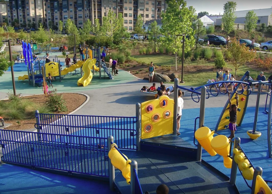
In addition to improved stormwater management, a previously underutilized space is now creating social value for the community. The park provides community gathering space, contributing to social cohesion. In the park there is a playground and splash pad for children to play, which helps to keep children physically active, improving children’s health. The park also provides recreational paths for biking and walking, contributing to diversity of transportation.

Fig: Playground located in the Historic Fourth Ward Park (Photo retrieved from http://www.h4wpc.org/photos-videos/)

Fig: Clear Creek Basin fountain (Photo retrieved from http://www.h4wpc.org/clear-creek-basin/)

Fig: Recreational bike path running alongside the Clear Creek Basin (Photo retrieved from http://www.h4wpc.org/clear-creek-basin/)

Sources:
The Environmental Protection Agency. (2017). Green infrastructure in parks: a guide to collaboration, funding, and community engagement. Retrieved from http://www.adaptationclearinghouse.org/resources/green-infrastructure-in-parks-a-guide-to-collaboration-funding-and-community-engagement.html

Atlanta, Georgia: BeltLine Project

City: Atlanta
Country / US State / US Territory: Georgia
Type of Solution: Railways
Climate Impact: Extreme Temperatures and Urban Heat Island Effect; Air Quality; Extreme Precipitation and Flooding
Social Value Created: Diverse Transportation; Connectivity; Water Security and Quality; Active Living and Playspaces

Fig: Map of the Atlanta BeltLine (Retrieved from https://beltline.org/about/the-atlanta-beltline-project/atlanta-beltline-overview/)
The Atlanta BeltLine project is a rails to trails project that is converting 22 miles of abandoned railway beds into recreational trails for biking and pedestrians, as well as a streetcar line. The project will restore 700 acres of greenspace and create an additional 1,300 acres of greenspace. The $4.8 billion project begun in 2006 and is expected to be completed in 2030.

Greenspace improves air quality and contributes to urban cooling, counteracting extreme temperatures and the urban heat island effect. Additionally, the green infrastructure slows and captures stormwater during heavy rain events, presenting flooding.

The BeltLine project also creates social value for the community. The BeltLine project increases diversity of transportation and improves connectivity between 45 neighborhoods of varying socioeconomic statuses and ethnicities. The greenspace will also help to filter water, improving water quality. Another unique feature of the BeltLine project is an outdoor public art-exhibit, displaying the work of more than 70 artists over the course of 9 miles of the BeltLine, contributing to the city’s arts and culture.

Fig: Before and after completion of the Eastside Trail portion of the BeltLine (Retrieved from https://beltline.org/places-to-go/eastside-trail/)

Fig: William Massey’s “The Art of Reconciliation” sculpture, an example of art displayed on the BeltLine trail (Retrieved from https://www.wheretraveler.com/atlanta/art-beltline)

Sources: Historic Fourth Ward Park Conservancy. (n.d.). Clear Creek Basin. Retrieved from http://www.h4wpc.org/clear-creek-basin/.

The Adaptation Clearinghouse. (n.d.). Case study of the Atlanta BeltLine – adaptation aspects. Retrieved from http://www.adaptationclearinghouse.org/resources/case-study-of-the-atlanta-beltline-adaptation-aspects.html.

WhereTraveler. (n.d.). Art on the beltline. Retrieved from https://www.wheretraveler.com/atlanta/art-beltline.