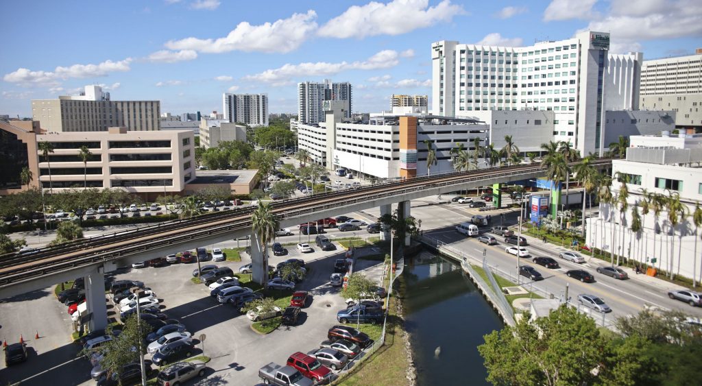
US – South

Miami, Florida: Wagner Creek Restoration

City: Miami
Country / US State / US Territory: Florida
Type of Solution: Habitat Restoration
Climate Impact: Seal level rise; Hurricanes and Storm Surge; Extreme Precipitation and Flooding
Social Value Created: Public Education; Community Engagement; Community Wellbeing and Quality of Life; Urban Beautification
Cost: $18.4 million
Funding Source: Public Space Challenge grant

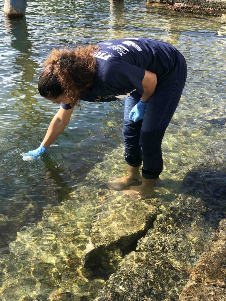
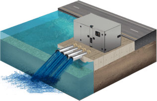
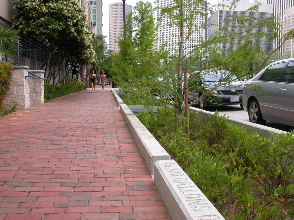
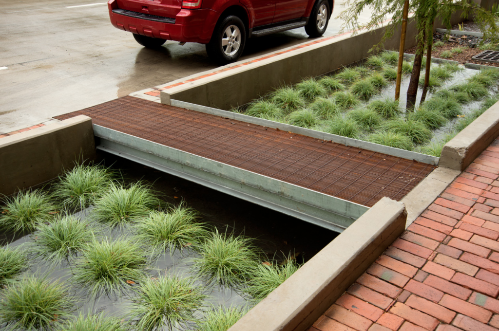
The Nature Conservancy (TNC) partnered with Greater Miami and the Beaches on a project to revitalize Wagner Creek. Over the years, Wagner Creek has been a site of illegal dumping, leaking pipe systems, and stormwater runoff from nearby auto-repair shops, making it one of the most polluted water bodies in Florida. The project will use green infrastructure improve stormwater management in response to flooding from heavy precipitation events and storm surge, as well as to remove pollutants and improve water quality.

Green infrastructure also provides shade, helping to cool the urban environment and mitigate extreme temperatures and the urban heat island effect. Additionally, the project aims to improve community well-being and contribute to urban beautification.

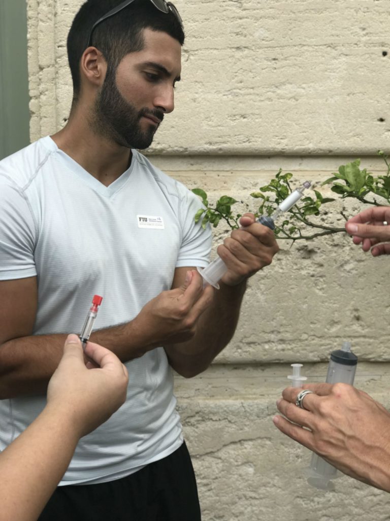
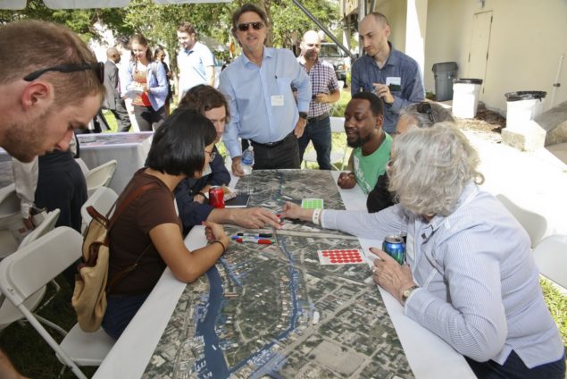
During the design phase of the project, TNC held a public visioning workshop that engaged stakeholders with various backgrounds. Stakeholders identified different services the project could provide and were given stickers to prioritize these services, such as larger/smaller parking lots, parks, tree plantings, and improve water quality for recreation. Then, the University of Miami Landscape Architecture department assisted with developing designs that could be implemented, incorporating climate change projections and other datasets, contributing to the advancement of education. A number of parks are planned as part of the project, and these parks will serve an estimated 100,000 people that live and work in the area.

Fig: Wagner Creek (Photo retrieved from https://www.nature.org/ourinitiatives/regions/northamerica/unitedstates/florida/explore/florida-wagner-creek-restoration.xml)

Fig: Residents prioritizing services during vision workshop (Photo retrieved from https://communitynewspapers.com/brickell/the-nature-conservancy-launches-effort-to-revitalize-the-banks-of-wagner-creek/)

Sources:

Heffernan, J. (November 25, 2017). The Nature Conservancy launches effort to revitalize the banks of Wagner Creek. Miami’s Community Newspapers. Retrieved from https://communitynewspapers.com/brickell/the-nature-conservancy-launches-effort-to-revitalize-the-banks-of-wagner-creek/.

The Nature Conservancy. (November 8, 2017). The Nature Conservancy to revitalize Wagner Creek. Retrieved from https://www.nature.org/ourinitiatives/regions/northamerica/unitedstates/florida/newsroom/florida-revitalizing-miamis-wagner-creek.xml.

The Nature Conservancy. (n.d.). The greening of Wagner Creek. Retrieved from https://www.nature.org/ourinitiatives/regions/northamerica/unitedstates/florida/explore/florida-wagner-creek-restoration.xml.

*Note: This case was documented from an interview with a city practitioner.

Miami, Florida: Citizen Science Sampling Campaign for King Tides

City: Miami
Country / US State / US Territory: Florida
Type of Solution: Awareness Campaign
Climate Impact: Sea Level Rise
Social Value Created: Public Education; Community Engagement; Social Justice and Equity for Vulnerable Communities; Public Health and Safety

During King Tides, groundwater rises and seeps up into low-lying communities. While currently these events only occur a few times a year, they could occur as frequently as 30 to 40 times a year by 2030. Florida International University (FIU) is leading a volunteer program to help map and collect data on these King Tides, helping to inform adaptation solutions.

Local community members volunteer for a few hours during these King Tides to take and record measurements in a phone application, recording the depth, length, and location of the King Tide. This method improve community awareness and helps to engage community members in solution development.

One of these sampling events, Sea Level Solutions Day, occurred on November 4, 2017. Over 75 citizen scientists volunteered, assisting in sampling in six different Miami neighborhoods. Samples were taken for traces of fecal coliform and other indicators of contamination.

Fig: Citizen scientist, Lesly Abreu, collecting flood water samples at Vizcaya Museum and Gardens for Sea Level Solutions (Photo retrieved from https://slsc.fiu.edu/solutions/outreach-and-engagement/citizen-science/sea-level-solutions-day/index.html)

Fig: Citizen scientist, Bryan Palacio, testing flood water samples for bacterial content (Photo retrieved from https://slsc.fiu.edu/solutions/outreach-and-engagement/citizen-science/sea-level-solutions-day/index.html)

Sources

Florida International University Sea Level Solutions Center. (n.d.). Citizen Science. Retrieved from https://slsc.fiu.edu/solutions/outreach-and-engagement/citizen-science/index.html.

Florida International University Sea Level Solutions Center. (n.d.). Sea Level Solutions Day. Retrieved from https://slsc.fiu.edu/solutions/outreach-and-engagement/citizen-science/sea-level-solutions-day/index.html.

New Delhi Times Bureau. (December 9, 2017). Miami citizens become scientists to study rising seas. Retrieved from https://www.newdelhitimes.com/miami-citizens-become-scientists-to-study-rising-seas/.

*Note: This case was documented from an interview with a city practitioner.

Washington, D.C.: Smart Roof Program

City: Washington
Country / US State / US Territory: D.C.
Type of Solution: Roof
Climate Impact: Extreme Temperatures and Urban Heat Island Effect
Social Value Created: Educational and Career Development Opportunities; Employment Opportunities; Public Health and Safety

Washington, D.C. has a Smart Roof Program that was implemented to counteract the Urban Heat Island (UHI) effect. The program integrated roof asset and energy management projects to retrofit roofs of 435 buildings, totalling 321 acres of roof area, including schools, police stations, fire stations, park and recreation centers, and office buildings.

Program objectives include energy conservation, stormwater management, heat reflection, solar energy production, carbon management, and leading through use of best practices and community involvement. The Washington, D.C. Department of General Services is projected to save $33 million over 20 years and will result in a reduction of 20,000 metric tons of CO2e annually. Additionally, the project addressed safety issues of the aging roofs.

The program focused on two types of roofs: vegetative (green) roofs and cool roofs. Vegetative roofs are used to teach students about botany, and solar PV installations on cool roofs are used as vocational education for students on renewable energy technologies through the DC Greenworks apprenticeship program. Projects were also used to support job creation and training in the local community.

Sources:
Bluefin. (n.d.). Success stories: SmartRoof Program makes Washington DC one of the greenest cities in America. Retrieved from http://www.bluefinllc.com/success-stories/smartroof-program-makes-washington-dc-one-of-the-greenest-city-in-america/.

Rast, Richard. (October, 2013). Washington D.C. Smart Roof Program. Bluefin.

The Adaptation Clearinghouse. (n.d.). Washington D.C. smart roof – roof asset and energy management program. Retrieved from http://www.adaptationclearinghouse.org/resources/washington-d-c-smart-roof-roof-asset-and-energy-management-program.html.

Tampa, Florida: Strawberry Advisory System

City: Tampa
Country / US State / US Territory: Florida
Type of Solution: Agriculture
Climate Impact: Invasive Species and Pests
Social Value Created: Food Security and Nutrition; Living Wages
Cost: N/A
Financing: N/A

Fungus is common in Florida’s humid climate that will rot strawberries, and may become a larger problem in the future. To avoid rot, farmers overspray strawberries, costing them time and money. Additionally, the fungus may develop a resistance to the fungicide if the chemicals are sprayed too frequently. A system was developed to monitor temperature, leaf wetness, humidity and local weather to alert farmers when they should be spraying fungicide.

Improving crop yields and reducing fungicide use reduces operational costs, helping to ensure living wages for farmers. Improving crop yields also supports food security and nutrition, and reducing fungicide use reduces the environmental impact of agricultural practices. Additionally, customers have started to demand more natural strawberries, and reducing chemical use helps to meet customer expectations.

Freeman, J. (October 10, 2014). Strawberry growers reap profits with less spray, more science. NOAA Climate.gov. Retrieved from https://www.climate.gov/news-features/climate-case-studies/strawberry-growers-reap-profits-less-spray-more-science.

U.S. Climate Resilience Toolkit. (January 17, 2017). Alert system helps strawberry growers reduce costs. Retrieved from https://toolkit.climate.gov/case-studies/alert-system-helps-strawberry-growers-reduce-costs.

Miami Florida, Citizens Oversight Board for Miami Forever Bond

City: Miami
Country / US State / US Territory: Florida
Type of Solution: Awareness Campaign / Community Outreach and Education Program
Climate Impact: Sea Level Rise; Hurricanes and Extreme Storms; Extreme Precipitation and Flooding
Social Value Created: Community Engagement; Social Justice and Equity for Vulnerable Communities

Miami faces flooding risks due to sea level rise and inundation, extreme precipitation, and hurricanes and storm surge. Miami received a $400 million general obligation bond (GOB), and $192 million of the bond was dedicated to projects to manage sea level rise and flooding. GOBs are typically used for non-bankable projects, which are projects where there is not a consistent stream of revenue generated. Projects will include solutions such as drainage systems and anti-flooding pumps, raised roads, and sea walls.

The Citizens Oversight Board was created to help oversee these projects and allow for residents to have input into the projects. Local community non-profit organizations, Catalyst Miami and Miami Climate Alliance, provided recommended criteria for board members selected. For example, the board members must reflect the overall composition / demographics of the city, composed of a diverse group of residents.

The Citizens Oversight Board review process includes examination of projects’ social, environmental, and economic benefits. Projects aim help to address socioeconomic inequality issues affecting vulnerable communities, as well.

Fig: Graphic showing a drainage system and anti-flooding pumps, raised road, and seawall (Photos Retrieved from https://www.miamiforever.org/)

Fig: Flyer distributed by Miami Climate Alliance asking community members to request use of the recommended criteria for the selection Citizen Oversight Board members. (Photo Retrieved from https://allevents.in/miami-dade%20county/miami-forever-bond-community-town-hall/2127379124215298 )

Sources:
City of Miami. [City of Miami Gov]. (September 22, 2017). City of Miami Forever General Obligation Bond [Video File]. Retrieved from http://miamigov.com/miamiforever/#faq.

Flechas, J. (March 23, 2018). Miami will spend $400 million on drainage, housing and parks. How can residents have a say? Miami Herald. Retrieved from https://www.miamiherald.com/news/local/community/miami-dade/article206618409.html.

Miami Forever. Investing in Infrastructure. Retrieved from https://www.miamiforever.org/.

Stein, K. (November 9, 2017). What’s next on the $400 million Miami Forever Bond. WLRN. Retrieved from http://wlrn.org/post/whats-next-400-million-miami-forever-bond.

Urban Environment League of Greater Miami (UEL). (November 4, 2017). Taking a look at the Miami Forever Bond. UEL. Retrieved from http://uel.org/2017/11/04/taking-a-look-at-the-miami-forever-bond/

*Note: This case was documented from an interview with a city practitioner.

Miami, Florida: King Tide Outreach Program

City: Miami
Country / US State / US Territory: Florida
Type of Solution: Awareness Campaign
Climate Impact: Sea level rise and inundation, extreme precipitation and flooding, hurricanes and storm surge
Social Value Created: Public Education and Awareness; Community Engagement; Social Justice and Equity for Vulnerable Communities

Many coastal areas are currently privately owned. Miami is low lying, so both coastal and non-coastal areas will flood due to sea level rise, heavy precipitation events, and hurricanes and storm surge. The King Tide Outreach Program is an awareness campaign launched by the City of Miami. Community non-profits partnered with the City of Miami to hold the campaign.

Last fall, the King Tide Outreach Program focused on educating Shore Crest, a mixed income and diverse neighborhood. Many residents are renters and are unaware of the causes of flooding. Residents have had issues with being able to go to work during flooding events.

The campaign engaged in a number of outreach activities, including social media, door to door messaging, and distribution of digital flyers. The City of Miami used Facebook and Twitter messages to communicate information to followers. The Facebook page has 6,423 followers, and the Twitter page has 111,000 followers. A Youtube video titled, “City of Miami – King Tides in Shorecrest,” was created as another educational communication during a Citizen Science collection day. The video has received 1,325 views thus far.

Prior to each King Tide event, messages were posted on New Door to directly reach City of Miami residents. An estimated 15,500 residents were reached for Citywide King Tide messages, and an estimated 125 residents were reached in the targeted Shorecrest/Haynsworth Village messages.

The Upper Eastside NET office served as an outreach post for Shorecrest residents, providing King Tide information and resources. Between 10 to 15 residents contacted the NET Offices for more information about the King Tides. Additionally, four community meetings were held and seven variable message signs were placed around the city to warn of King Tides.

Fig: Example of digital flyer distributed via Twitter, showing safety information on the front (left) and a map of affected areas on the back (left) (Image retrieved from https://twitter.com/CityofMiami/status/926777359327547392)

Sources

*Note: This case was documented from an interview with a city practitioner.

Miami, Florida: Eyes on the Rise Toolkit

City: Miami
Country / US State / US Territory: Florida
Type of Solution: Awareness Campaign / Community Outreach and Education Program
Climate Impact: Seal Level Rise; Hurricanes and Storm Surge; Extreme Precipitation and Flooding
Social Value Created: Public Education; Community Engagement; Social Justice and Equity for Vulnerable Communities

The Eyes on the Rise Toolkit is a Florida International University project that is aimed at informing citizens of South Florida about the potential impact of sea level rise in their neighborhoods. The Toolkit is an application that allows citizens to enter their location to see a sea level rise simulation and show elevation data.

Citizens are also provided with data and resources, including flooding reports, flood insurance data, tide measurement, elevation, and groundwater levels. Citizens can also use the application to report a flood. The Toolkit is aimed to help improve community knowledge systems, increasing community awareness and engage vulnerable communities in sea level rise adaptation.

Fig: Eyes on the Rise Toolkit application interface (Photo retrieved from http://citizeneyes.org/app/)

Sources: Eyes on the Rise. (n.d.). About the app. Retrieved from http://www.eyesontherise.org/about-the-app/.

*Note: This case was documented from an interview with a city practitioner.

Miami, Florida: CLEAR Miami

City: Miami
Country / US State / US Territory: Florida
Type of Solution: Volunteer / Community Group Program
Climate Impact: Seal Level Rise; Hurricanes and Storm Surge; Extreme Heat and Urban Heat Island Effect; Infectious Disease
Social Value Created: Public education and awareness, community engagement, social cohesion, benefits vulnerable communities

Catalyst Miami is a community organization that has conventionally focused on providing social services, such as health coaching and financial planning. Recently, the group has begun to engage vulnerable communities in local climate initiatives.

In 2016, Catalyst Miami launched its CLEAR Miami (Community Leadership on the Environment, Advocacy, and Resilience) program. CLEAR Miami is a 12 week program that teaches residents how to participate in the climate planning process, including the basics of climate change science, types of adaptation strategies, communication skills for public speaking, and how to create an asset map for their neighborhoods.

Community members learn about the risk of Seal Level Rise and Inundation, hurricanes and storm surge, extreme heat and the urban heat island effect, and the spread of infectious disease. The program focuses on financially vulnerable populations given their disproportionate level of risks to climate impacts. Those who participate in the program are provided dinner and childcare for free.

The Southeast Florida Climate Compact is working on updating an adaptation plan and developing a mitigation plan. Catalyst Miami is working on engaging residents in this planning process to ensure equitable solutions are chosen.

Fig: The first CLEAR Miami graduates (Photo retrieved from https://catalystmiami.org/climate-resilience-local-engagement/)

Fig: CLEAR Miami Youth graduates talking about why they advocate for climate change (Photo retrieved from https://catalystmiami.org/climate-resilience-local-engagement/)

Sources: Delahunty, M. (2016). Catalyst Miami launches pioneering climate resilience training in South Florida. Catalyst Miami. Retrieved from

United States Water Alliance. (2017). An equitable water future: a national briefing paper. Retrieved from http://uswateralliance.org/sites/uswateralliance.org/files/publications/uswa_waterequity_FINAL.pdf

*Note: This case was documented from an interview with a city practitioner.

Houston, Texas: Lower Footprint Biofiltration

City: Houston
Country / US State / US Territory: Texas
Type of Solution: Streets and Parking Lots
Climate Impact: Hurricanes and Storm Surge; Extreme Precipitation and Flooding; Air Quality
Social Value Created: Diverse Transportation; Urban Beautification; Public Health and Safety; Water Security and Quality
Cost: $9.6 million
Funding:

Bagby Street, a ten-block corridor in a dense, urban neighborhood underwent a redevelopment project. The project improved stormwater management to reduce flooding risks during hurricanes and severe storms. Green infrastructure systems were used to store and filter runoff, reducing flooding risk and improving water quality. The system has a smaller footprint than typical biofiltration systems, requiring only 1/20th of the space. 33% of stormwater runoff is captured by the system, removing 75% bacteria, 73% phosphorous, 93% oil and grease, 43% nitrogen, and 85% total suspended solids. Trees were also planted to aid with stormwater management, increasing the number of trees by 165%.

Additionally, the project improved traffic congestion and walkability, as well as the overall aesthetic appeal of the road, contributing to diverse transportation, public health and safety, and urban beautification. The smaller footprint design was essential for managing stormwater given the limited space available for green infrastructure. Private development also increased as a result of the project, totaling to $25 million in new development.

Fig: Sidewalk area with rain garden biofiltration system (Photo retrieved from http://www.uta.edu/faculty/nickfang/downloads/UTA_LID_2014/05_Batts_Penland_2014.pdf)

Fig: A portion of the biofiltration system (Photo retrieved from https://www.the-atlas.com/project?id=341#)

Sources: Atlas. (n.d.). Lower footprint biofiltration to increase efficiency in right of way stormwater capture. Retrieved from https://www.the-atlas.com/project?id=341#.

Baltimore, Maryland: Growing Green Initiative

City: Baltimore
Country / US State / US Territory: Maryland
Type of Solution: Green Infrastructure
Climate Impact: Extreme Temperatures and Urban Heat Island Effect; Air Quality; Extreme Precipitation and Flooding
Social Value Created: Social Cohesion; Educational and Career Development Opportunities; Food Security and Nutrition; Water Quality; Community Engagement; Arts and Culture

The City of Baltimore launched its Growing Green Initiative (GGI) in 2014. The program works to repurpose vacant lots into community assets, such as green infrastructure, community gardens and urban farms, recreational space, and open space for community gatherings. Residents have the ability to adopt a lot. Thus far, the city has successfully repurposed nearly 800 vacant lots.

Green infrastructure helps to manage stormwater by increasing the amount of pervious surfaces for on-site water treatment, reducing flooding and thereby improving community health and safety. Lots are also used to increase the tree canopy and increase the urban forest, helping to mitigate the urban heat island effect, improve air quality, and act as a buffer along railways and highways.

Some lots have been converted into community gardens and urban farms to help combat Baltimore’s food deserts, improving food security and nutrition, as well as increase social cohesion. Other lots have been converted into community gathering spaces and play spaces, improving social cohesion and increasing physical activity of children, improving children’s health.

One vacant lot was transformed into a sculpture park on Homestead Street in East Baltimore, contributing to the community’s arts and culture. Employment and job training opportunities are also created by this program for landscape maintenance and planting, stormwater facility development, urban farming, and food systems.

In 2016, the City of Baltimore partnered with the United States Environmental Protection Agency and Chesapeake Bay Trust to hold a competition, the Growing Green Design Competition: Vacant Lots Transformed. The competition engaged community groups, design firms, non-profit, and private partners to develop ideas for transforming vacant lots. Seven projects were awarded $300,000 to design and construct their ideas.

Fig: Guide for repurposing vacant lots in Baltimore, Maryland (Retrieved from https://www.baltimoresustainability.org/wp-content/uploads/2015/12/Green_Pattern_Book.pdf).

Fig: Urban agriculture on a vacant lot (Retrieved from https://www.baltimoresustainability.org/projects/baltimore-green-network/)

Fig: Sculpture park on a former vacant lot on Homestead Street in East Baltimore (Retrieved from https://www.baltimoremagazine.com/2017/6/20/vacant-lot-transforms-into-sculpture-park-in-east-baltimore).

Sources:
Dillin, A. L. (June 20, 2017). Vacant lot transforms into sculpture park in East Baltimore. Baltimore Magazine. Retrieved from https://www.baltimoremagazine.com/2017/6/20/vacant-lot-transforms-into-sculpture-park-in-east-baltimore.

The Climate Adaptation Clearinghouse. (May, 2014). Baltimore, Maryland Growing Green Initiative. Retrieved from http://www.adaptationclearinghouse.org/resources/baltimore-maryland-growing-green-initiative.html.

United States Forest Service. (2015). Green pattern book: using vacant land to create greener neighborhoods in Baltimore. Retrieved from https://www.baltimoresustainability.org/wp-content/uploads/2015/12/Green_Pattern_Book.pdf.