New York, New York: Living Breakwaters

City: New York
Country / US State / US Territory: New York
Type of Solution: Seawalls and Living Shorelines
Climate Impact: Seal Level Rise; Hurricanes and Storm Surge; Extreme Precipitation and Flooding
Social Value Created: Educational and Career Development Opportunities; Active Living and Recreation; Community Engagement; Social Cohesion; Arts and Culture
Cost: $60 million
Funding Source: U.S. Department of Housing and Urban Development Rebuild by Design competition

Living Breakwaters is a project aimed at helping to reduce wave energy, lowering flooding risks during extreme storm events. The project was developed by SCAPE landscape Architecture for the Rebuild Design Competition, a competition held by the U.S. Department of Housing and Urban Development (HUD) to improve coastal resilience in response to Hurricane Sandy.

The Living Breakwaters approach uses structures to restore and enhance marine habitats, as well as improve biodiversity. Structures include reef ridges, reef streets, crenulated crests, and bio-enhancing concrete. This habitat mimics historic oyster reefs, which helps to restore the oyster population.

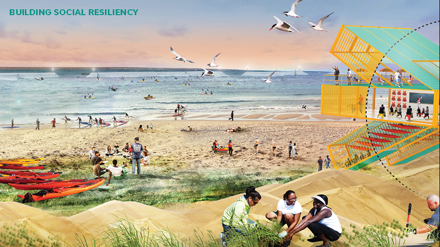
Additionally, the project co-creates social value. The project will help to prevent beach erosion and protect property values. The project also will improves access to the shoreline an recreational opportunities such as boating and fishing.

Also, an on-land Water Hub will be constructed on shore for visitoring groups, recreation, and educational programs. The Harbor School and Billion Oyster Project will create educational opportunities for local schools to learn about ecological stewardship and how they can help to protect Staten Island’s coastline. Implementation of the project also provides educational opportunities for research and skill development through project monitoring.
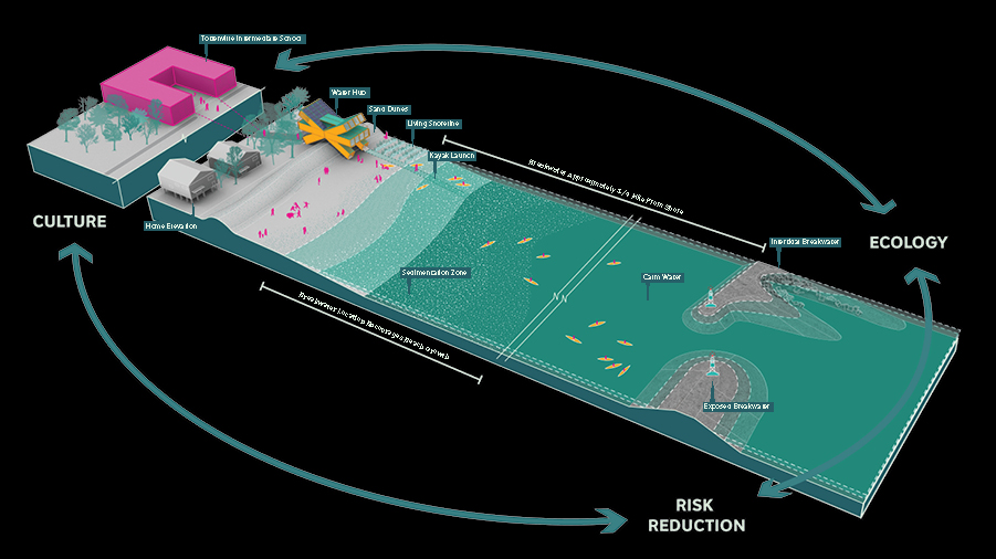
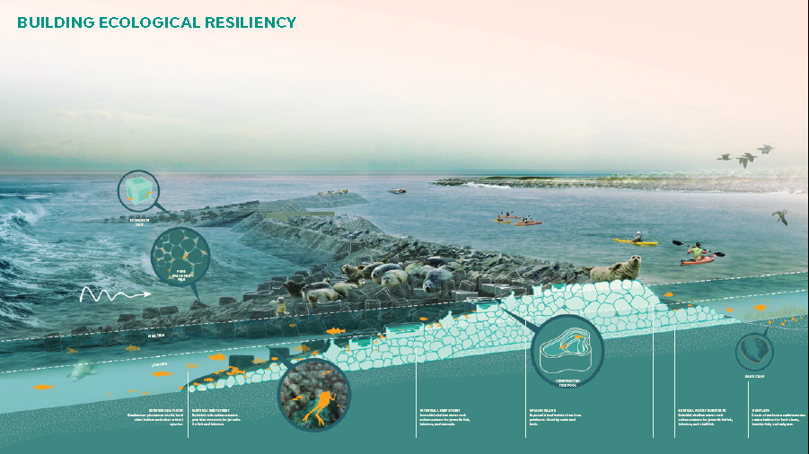
Fig: Graphic showing the project design and connection between risk reduction, ecology, and culture (Image retrieved from http://www.rebuildbydesign.org/our-work/all-proposals/winning-projects/ny-living-breakwaters)

Fig: Graphic showing more specifics about the project’s landscape architecture design (Image retrieved from http://www.rebuildbydesign.org/our-work/all-proposals/winning-projects/ny-living-breakwaters)

Fig: Rendering of the Living Breakwaters project featuring contributions to social resilience (Image retrieved from http://www.rebuildbydesign.org/our-work/all-proposals/winning-projects/ny-living-breakwaters)

Sources

Atlas. (n.d.). Creating protective infrastructure to reduce coastal risk, enhance aquatic habitat, and foster social resilience. Retrieved from https://www.the-atlas.com/project?id=374#.

New York State. (n.d.). Learn more about the Living Breakwaters project. Retrieved from https://stormrecovery.ny.gov/learn-more-about-living-breakwaters-project.

Rebuild by Design. (n.d.). Living Breakwaters. Retrieved from http://www.rebuildbydesign.org/our-work/all-proposals/winning-projects/ny-living-breakwaters.

Seattle, Washington: Redevelopment Project

City: Seattle
Country / US State / US Territory: Washington
Type of Solution: Vacant Properties and Lots
Climate Impact: Extreme Precipitation and Flooding
Social Value Created: recreation; public gathering space; social cohesion; connectivity; employment; benefits vulnerable communities

The City of Seattle recently redeveloped undertook a nine-acre redevelopment project to repurpose an underutilized parking lot and the surrounding area. The Thornton Creek restoration is one component of the restoration project. Thornton Creek was previously been forced below the surface as the urban area developed.

The restoration project aimed to restore the creek to manage stormwater runoff from 680 acres. Impervious surfaces were also reduced by 78%, improving ground water infiltration and thereby reducing runoff. Native species were used for 85% of the project’s landscaping, reducing water consumption for landscaping and reducing maintenance needs. The project design also improves stormwater filtration to remove pollutants from stormwater runoff, removing 40-80% of total suspended solids from 91% of runoff in the 680 acre drainage basin.

Thornton Place is a combined residential and commercial space created in the redevelopment. The project added 530 units of mixed-income housing and 50,000 square feet of retail space, including 143 units of assisted-living housing for seniors. Thornton Place also includes a 14-screen cinema and a plaza area for public gatherings. Additionally, pedestrian links were created to link adjacent commercial and residential neighborhoods, improving walkability. Transit access was also improve by the design, increasing mobility and diversity of transportation.

Sources:
Benfield, K. (June 6, 2011). How to turn a parking lot into an ideal green community. The Atlantic. Retrieved from https://www.theatlantic.com/national/archive/2011/06/how-to-turn-a-parking-lot-into-an-ideal-green-community/239973/.

Benfield, K. (June 7, 2011). A seattle redevelopment that is greener than green. Grist Magazine. Retrieved from https://grist.org/urbanism/2011-06-06-seattle-urbanism-transit-state-of-the-art-green-mixed-planning/.

San Francisco, California: Public Utilities Commission Green Infrastructure Projects

City: San Francisco
Country / US State / US Territory: California
Type of Solution: Green Infrastructure, Streets
Climate Impact: N/A
Social Value Created: Diverse Transportation; Public Health and Safety; Active Living and Recreation; Public Education; Urban Beautification; Social Cohesion; Public Spaces

The San Francisco Public Utilities Commission (SFPUC) is implementing various green infrastructure projects to improve stormwater management as part of its Urban Watershed Assessment. San Francisco has a combined sewer system, posing an increased risk to public health during heavy precipitation events if sewers overflow.

In addition to stormwater management, social value has been co-created by many of the projects. Many projects improve walkability and bikeability of streets, traffic calming and reduced congestion, and provide more spaces for community gatherings, which contributes to urban beautification and increased social cohesion.

Thus far, SFPUC has completed six green infrastructure projects. Eight additional projects are currently underway. These projects were identified in a participatory planning workshop held by SFPUC in 2007.

Cesar Chavez Streetscape Improvement is a demonstration project for the Better Streets Plan that was completed in the Mission neighborhood. 18 rain gardens were constructed along a half mile portion of a street. Trees and drought-tolerant landscaping were also planted to help manage stormwater. Additionally, traffic-calming bulb-outs were constructed and a bike lane was created to improve pedestrian and bicycle safe.

Newcomb Avenue Green Street is another green infrastructure project that has been completed to improve stormwater management. This project focused on creation of community gathering spaces and urban beautification in addition to traffic calming improvements. Additionally, the project helped to improve property values for residents.

Sources:
City and County of San Francisco Planning Department. (n.d.). Newcomb Avenue model block streetscape improvement project. Retrieved from http://sf-planning.org/newcomb-avenue-model-block-streetscape-improvement-project.

The Adaptation Clearinghouse. (2016). San Francisco Public Utilities Commission green infrastructure projects. Retrieved from http://www.adaptationclearinghouse.org/resources/san-francisco-public-utilities-commission-green-infrastructure-projects.html.

Phoenix, Arizona: Civic Space Park

City: Phoenix
Country / US State / US Territory: Arizona
Type of Solution: Park
Climate Impact: Extreme Temperatures and Urban Heat Island Effect; Air Quality; Extreme Precipitation and Flooding
Social Value Created: Public Space; Social Cohesion; Diverse Transportation; Connectivity; Active Living and Recreation; Arts and Culture

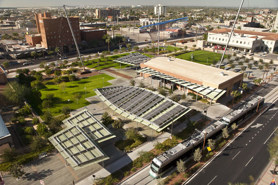
Phoenix, Arizona is a classic example of urban sprawl. The city is already facing issues with extreme temperatures, which is further amplified by the urban heat island effect. Civic Space Park is a 2.7 acre park located in Phoenix that includes green space with trees to mitigate extreme temperatures and provide shade for residents. Solar panels producing 75 kilowatts of renewable energy provide additional shade. Also, the green infrastructure improves stormwater management, which is helpful during monsoon season.

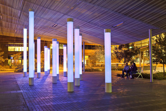
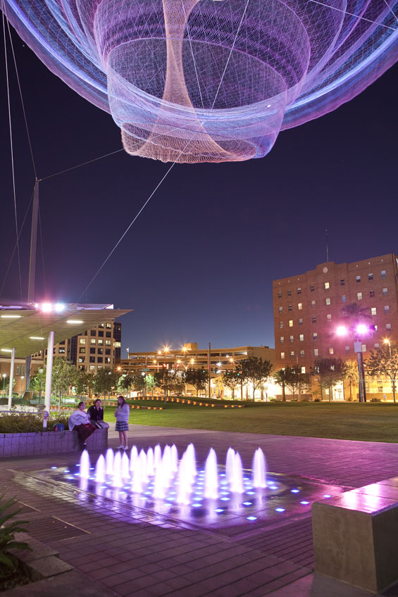
Not only is the park helpful in managing climate risks, but the park is a public space contributing the social cohesion and providing a number of other social benefits. The park features a number of artistic featurings, including a nighttime lighting show simulating lightning during a monsoon and an art installation, titled, “Her Secret is Patience.” This title arose from a phase used by Ralph Waldo Emerson that was inspired by elements of Arizona nature. There is also an interactive water feature, providing a playspace for children and adults.

The park promotes recreation and leisure, providing a turf landscape in the southwest corner of the park with pedestrian-scale retaining walls, game tables, benches, and densely spaced shade trees. The site is also located adjacent to the METRO Light Rail, increasing access to the park through improved connectivity and promoting diverse transportation.

Fig: Birds eye view of Civic Space Park (Photo retrieved from http://worldlandscapearchitect.com/civic-space-park-phoenix-usa-aecom/#.W1HvvdJKiUk)

Fig: LED lights with nighttime lighting show (Photo retrieved from http://worldlandscapearchitect.com/civic-space-park-phoenix-usa-aecom/#.W1HvvdJKiUk)

Fig: Interactive water feature with the “Her Secret is Patience” art installation above (Image retrieved from http://worldlandscapearchitect.com/civic-space-park-phoenix-usa-aecom/#.W1HvvdJKiUk)

Source: AECOM. (July 23, 2013). Civic Space Park, Phoenix USA. World Landscape Architecture. Retrieved from

*Note: This case was documented from an interview with a city practitioner.

Miami, Florida: CLEAR Miami

City: Miami
Country / US State / US Territory: Florida
Type of Solution: Volunteer / Community Group Program
Climate Impact: Seal Level Rise; Hurricanes and Storm Surge; Extreme Heat and Urban Heat Island Effect; Infectious Disease
Social Value Created: Public education and awareness, community engagement, social cohesion, benefits vulnerable communities

Catalyst Miami is a community organization that has conventionally focused on providing social services, such as health coaching and financial planning. Recently, the group has begun to engage vulnerable communities in local climate initiatives.

In 2016, Catalyst Miami launched its CLEAR Miami (Community Leadership on the Environment, Advocacy, and Resilience) program. CLEAR Miami is a 12 week program that teaches residents how to participate in the climate planning process, including the basics of climate change science, types of adaptation strategies, communication skills for public speaking, and how to create an asset map for their neighborhoods.

Community members learn about the risk of Seal Level Rise and Inundation, hurricanes and storm surge, extreme heat and the urban heat island effect, and the spread of infectious disease. The program focuses on financially vulnerable populations given their disproportionate level of risks to climate impacts. Those who participate in the program are provided dinner and childcare for free.

The Southeast Florida Climate Compact is working on updating an adaptation plan and developing a mitigation plan. Catalyst Miami is working on engaging residents in this planning process to ensure equitable solutions are chosen.

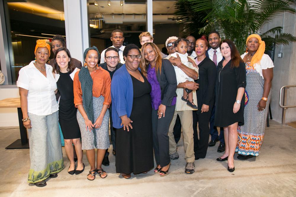
Fig: The first CLEAR Miami graduates (Photo retrieved from https://catalystmiami.org/climate-resilience-local-engagement/)

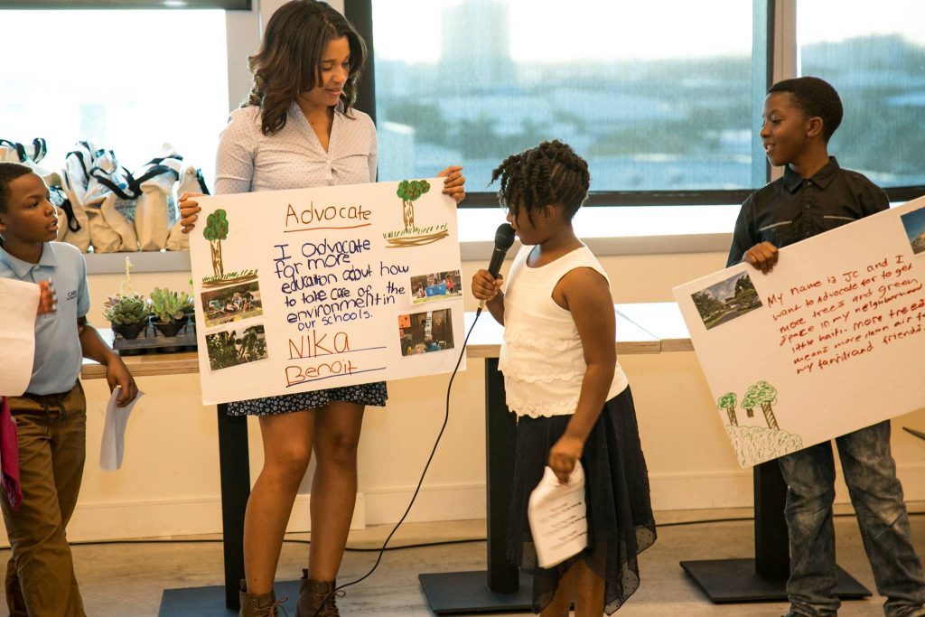
Fig: CLEAR Miami Youth graduates talking about why they advocate for climate change (Photo retrieved from https://catalystmiami.org/climate-resilience-local-engagement/)

Sources: Delahunty, M. (2016). Catalyst Miami launches pioneering climate resilience training in South Florida. Catalyst Miami. Retrieved from

United States Water Alliance. (2017). An equitable water future: a national briefing paper. Retrieved from http://uswateralliance.org/sites/uswateralliance.org/files/publications/uswa_waterequity_FINAL.pdf

*Note: This case was documented from an interview with a city practitioner.

Los Angeles, California: Green Alley

City: Los Angeles
Country / US State / US Territory: California
Type of Solution: Alleyway
Climate Impact: Extreme Temperatures and Urban Heat Island Effect; Air Quality; Extreme Precipitation and Flooding
Social Value Created: Connectivity; Diverse Transportation; Public Health and Safety; Community Engagement; Social Cohesion; Arts and Culture; Public Education and Awareness

Los Angeles has over 900 of miles of alleys that are often used for dumping and experience high instances of crime. The Trust for Public Land Climate Smart Cities program is a national program for assisting cities in projects to mitigate and adapt to climate change. The Avalon Green Alley Demonstration project repurposed a mile of underutilized alleyways in South Los Angeles into green alleys.

The Trust for Public Land Climate Smart Cities collaborated with the City of Los Angeles, UCLA, and Arizona State University to create green alleys in South Los Angeles. These green alleys improve air quality and contribute to urban cooling, mitigating extreme temperatures and the urban heat island effect.

The green alley also helps to filter pollutants from stormwater runoff and control stormwater, mitigating flooding and recharging the groundwater. Additionally, the repurposed alleyways provide recreational space and improve the walkability and bikeability of the area. The green alley creates a safe passageway between various key destinations in the area, including a grocery store and nearby schools. The safe passageway improves community connectivity.

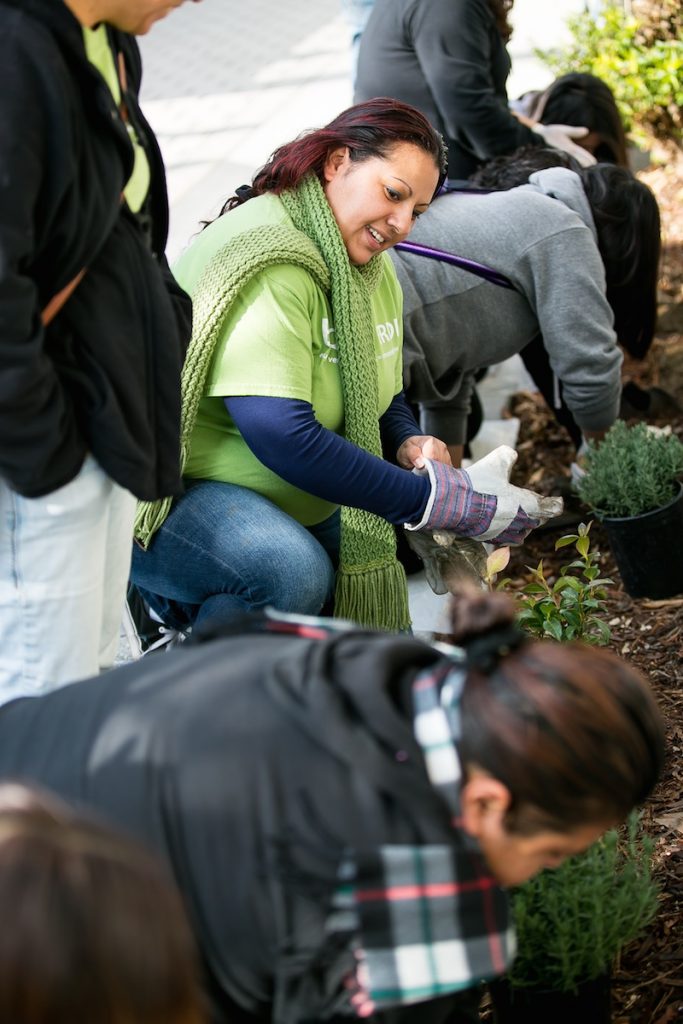
A volunteer group, Equipo Verde (Green Team), manages the green alley, organizing volunteer days, picking up garbage, and landscaping and planting trees. The group improves community engagement and educates the local community on the importance of managing these alleyways.

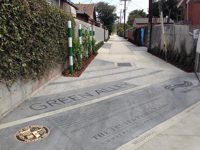
Fig: The Green Alley Demonstration Project completed by The Trust for Public Land (Retrieved from https://www.tpl.org/green-alleys#sm.0000ca4mkgzx8en8zd02b2m3nuov7)

Fig: Members of Equipo Verde working on the landscaping in the green alley (Retrieved from https://www.tpl.org/verde#sm.0000ca4mkgzx8en8zd02b2m3nuov7)

Sources: The Trust for Public Land. (March 17, 2016). Meet the Equipo Verde: allies for alleys. Retrieved from https://www.tpl.org/verde#sm.0000ca4mkgzx8en8zd02b2m3nuov7.

The Trust for Public Land. (n.d.). Green alleys. Retrieved from https://www.tpl.org/green-alleys#sm.0000ca4mkgzx8en8zd02b2m3nuov7.

Chicago, Illinois: Adsorptive Playgrounds

City: Chicago
Country / US State / US Territory: Illinois
Type of Solution: Streets
Climate Impact: Extreme Temperatures and Urban Heat Island Effect; Air Quality; Extreme Precipitation and Flooding
Social Value Created: Social Justice and Equity for Vulnerable Communities; Social Cohesion; Public Health and Safety; Active Living; Food Security
and Nutrition; Public Spaces and Playspaces

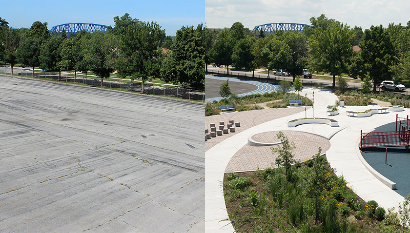
The Space to Grow program was started in 2013 to redevelop asphalt school lots into green infrastructure playgrounds for stormwater management. The playgrounds are designed to manage a 100-year storm lasting 24 hours. Additionally, green infrastructure filers air, improving air quality, and contributes to urban cooling, counteracting extreme temperatures and the urban heat island effect. As of 2016, six playgrounds have been completed and 28 more are planned for completion by 2019.

The playgrounds are also designed to create other social benefits. 90% of students serviced by the playgrounds are from low-income families, improving social resilience of vulnerable communities. Further, the playgrounds are intended to be educational and provide space for community gatherings, increasing social cohesion.

Grissom Elementary School is one school that participated in the Space to Grow program. The school redesigned a schoolyard to include outdoor classroom areas, community vegetable gardens, a jogging track, and green infrastructure for stormwater management. Community vegetable gardens improve access to nutritional food and increase social cohesion, and athletic facilities promote physical activity. Both increase access nutrition and engagement in physical activity helping to counteract childhood obesity, a growing crisis in the United States.

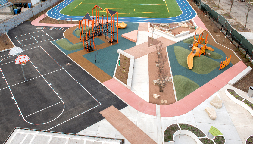
James Wadsworth Elementary School is a STEM school that also participated in the Space to Grow program. An unsafe, deterioration playground and basketball court were redesigned with the help of the students. The new design features a playground, basketball court, turf field, jogging track, two half-court basketball courts, and outdoor classroom areas. There are rain gardens that help manage stormwater runoff, and a decorative water feature that uses stormwater runoff captured from the roof.

Fig: Grissom Elementary School project (Photo retrieved from http://www.spacetogrowchicago.org/about/school-profiles/grissom-elementary/)

Fig: James Wadsworth Elementary School playground (Photo retrieved from http://www.spacetogrowchicago.org/about/school-profiles/james-wadsworth-elementary-school/)

Sources:
C40 Cities. (November 15, 2016). Cities100: Chicago – adsorptive playgrounds foster social cohesion. Retrieved from https://www.c40.org/case_studies/cities100-chicago-adsorptive-playgrounds-foster-social-cohesion.

Space to Grow. (n.d.). School profiles. Retrieved from http://www.spacetogrowchicago.org/about/school-profiles/.

Baltimore, Maryland: Growing Green Initiative

City: Baltimore
Country / US State / US Territory: Maryland
Type of Solution: Green Infrastructure
Climate Impact: Extreme Temperatures and Urban Heat Island Effect; Air Quality; Extreme Precipitation and Flooding
Social Value Created: Social Cohesion; Educational and Career Development Opportunities; Food Security and Nutrition; Water Quality; Community Engagement; Arts and Culture

The City of Baltimore launched its Growing Green Initiative (GGI) in 2014. The program works to repurpose vacant lots into community assets, such as green infrastructure, community gardens and urban farms, recreational space, and open space for community gatherings. Residents have the ability to adopt a lot. Thus far, the city has successfully repurposed nearly 800 vacant lots.

Green infrastructure helps to manage stormwater by increasing the amount of pervious surfaces for on-site water treatment, reducing flooding and thereby improving community health and safety. Lots are also used to increase the tree canopy and increase the urban forest, helping to mitigate the urban heat island effect, improve air quality, and act as a buffer along railways and highways.

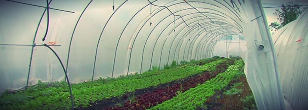
Some lots have been converted into community gardens and urban farms to help combat Baltimore’s food deserts, improving food security and nutrition, as well as increase social cohesion. Other lots have been converted into community gathering spaces and play spaces, improving social cohesion and increasing physical activity of children, improving children’s health.

One vacant lot was transformed into a sculpture park on Homestead Street in East Baltimore, contributing to the community’s arts and culture. Employment and job training opportunities are also created by this program for landscape maintenance and planting, stormwater facility development, urban farming, and food systems.

In 2016, the City of Baltimore partnered with the United States Environmental Protection Agency and Chesapeake Bay Trust to hold a competition, the Growing Green Design Competition: Vacant Lots Transformed. The competition engaged community groups, design firms, non-profit, and private partners to develop ideas for transforming vacant lots. Seven projects were awarded $300,000 to design and construct their ideas.

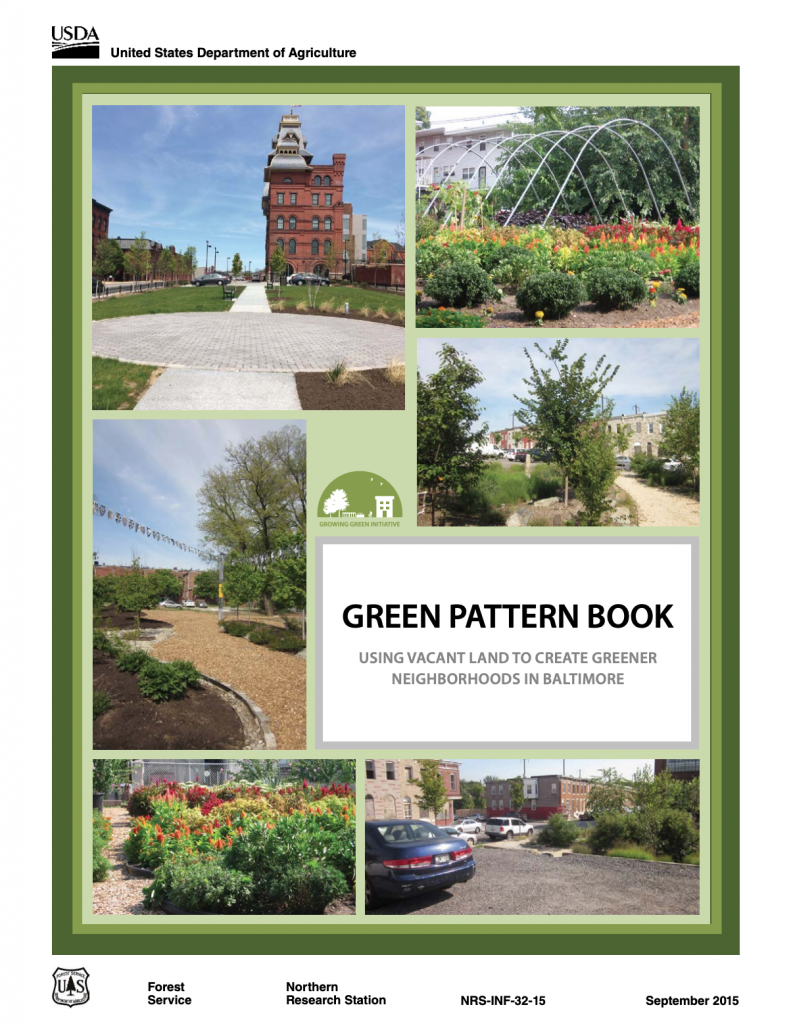
Fig: Guide for repurposing vacant lots in Baltimore, Maryland (Retrieved from https://www.baltimoresustainability.org/wp-content/uploads/2015/12/Green_Pattern_Book.pdf).

Fig: Urban agriculture on a vacant lot (Retrieved from https://www.baltimoresustainability.org/projects/baltimore-green-network/)

Fig: Sculpture park on a former vacant lot on Homestead Street in East Baltimore (Retrieved from https://www.baltimoremagazine.com/2017/6/20/vacant-lot-transforms-into-sculpture-park-in-east-baltimore).

Sources:
Dillin, A. L. (June 20, 2017). Vacant lot transforms into sculpture park in East Baltimore. Baltimore Magazine. Retrieved from https://www.baltimoremagazine.com/2017/6/20/vacant-lot-transforms-into-sculpture-park-in-east-baltimore.

The Climate Adaptation Clearinghouse. (May, 2014). Baltimore, Maryland Growing Green Initiative. Retrieved from http://www.adaptationclearinghouse.org/resources/baltimore-maryland-growing-green-initiative.html.

United States Forest Service. (2015). Green pattern book: using vacant land to create greener neighborhoods in Baltimore. Retrieved from https://www.baltimoresustainability.org/wp-content/uploads/2015/12/Green_Pattern_Book.pdf.

Atlanta, Georgia: Historic Fourth Ward Park

City: Atlanta
Country / US State / US Territory: Georgia
Type of Solution: Vacant Commercial Properties and Lots
Climate Impact: Extreme Temperatures and Urban Heat Island Effect; Air Quality; Extreme Precipitation and Flooding
Social Value Created: Social Cohesion; Quality of Life; Public Health and Safety; Diverse Transportation; Historic Preservation; Public Spaces; Active Living and Playspaces

A former industrial and commercial property has been revitalized to become a 17-acre urban park, Historic Fourth Ward Park. The park is adjacent to the Atlanta BeltLine project, a rails to trails project that is restoring 22 miles of abandoned railway beds into recreational trails and a streetcar line. The $ project was completed in 2011, and the use of green infrastructure opposed to traditional gray infrastructure drainage system the city is estimated to have saved $15 million.

The park is located in an area that historically has experienced flooding and sewer overflows during storms. The green infrastructure system, consisting of bioretention, underground cisterns, and pervious surfaces, will help to improve stormwater management, with the capacity to capture runoff for a 100-year storm. Preventing sewer overflows helps to counteract the spread of waterborne diseases, contributing to public health.

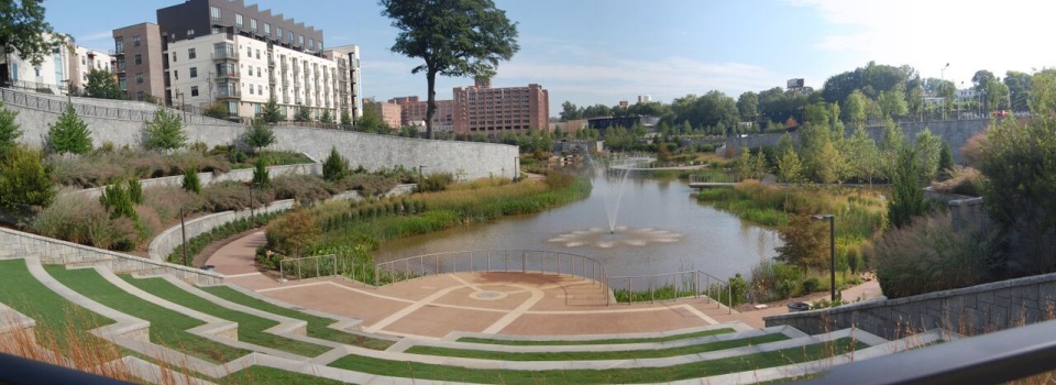
One of the park’s features is a two-acre stormwater detention pond, Clear Creek Basin, which has already helped to reduce flooding in the surrounding neighborhoods. The Basin not only reduces flooding, but it also acts as a water reserve providing 425 gallons per minute even during a drought. The Basin was designed to use plantings and landscaping strategies used in wetlands.

Additionally, the greenspace improves air quality and contributes to urban cooling, mitigating extreme temperatures and the urban heat island effect. Trees and play structures increase shade, improving the comfort of community members and their overall quality of life.

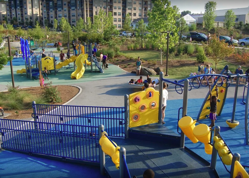
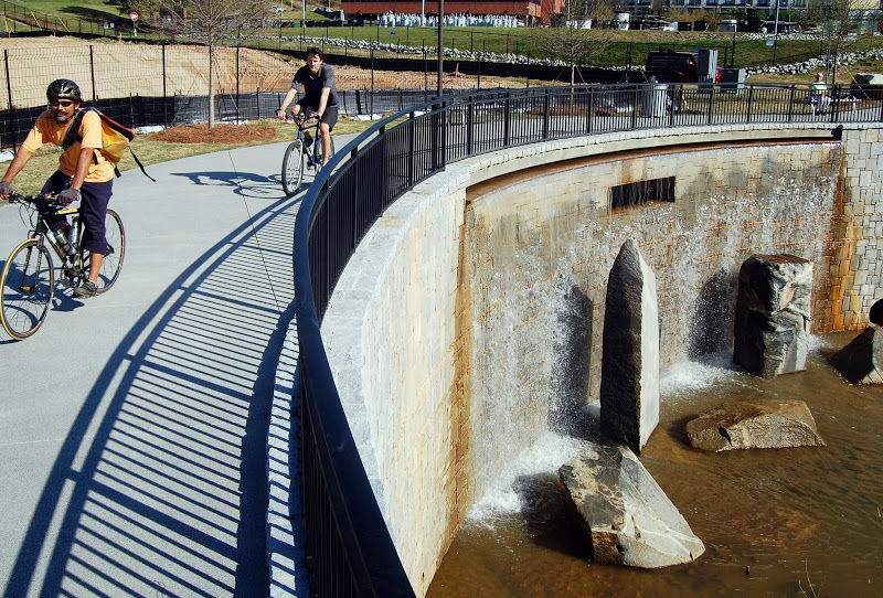
In addition to improved stormwater management, a previously underutilized space is now creating social value for the community. The park provides community gathering space, contributing to social cohesion. In the park there is a playground and splash pad for children to play, which helps to keep children physically active, improving children’s health. The park also provides recreational paths for biking and walking, contributing to diversity of transportation.

Fig: Playground located in the Historic Fourth Ward Park (Photo retrieved from http://www.h4wpc.org/photos-videos/)

Fig: Clear Creek Basin fountain (Photo retrieved from http://www.h4wpc.org/clear-creek-basin/)

Fig: Recreational bike path running alongside the Clear Creek Basin (Photo retrieved from http://www.h4wpc.org/clear-creek-basin/)

Sources:
The Environmental Protection Agency. (2017). Green infrastructure in parks: a guide to collaboration, funding, and community engagement. Retrieved from http://www.adaptationclearinghouse.org/resources/green-infrastructure-in-parks-a-guide-to-collaboration-funding-and-community-engagement.html